
Operational High Resolution Hydrodynamic Forecast Model for Cook Strait
MetOcean Solutions has recently operationalised a high-resolution hydrodynamic forecast model for the wider Cook Strait region and Marlborough Sounds, New Zealand. The Cook Strait region represents the main artery between the North and South Island, while the Marlborough Sounds is the hub of New Zealand aquaculture, with 2,153 ha of marine farms that product more than 50,000 tonnes (live weight) per year of Kuku, or green-lipped mussels.
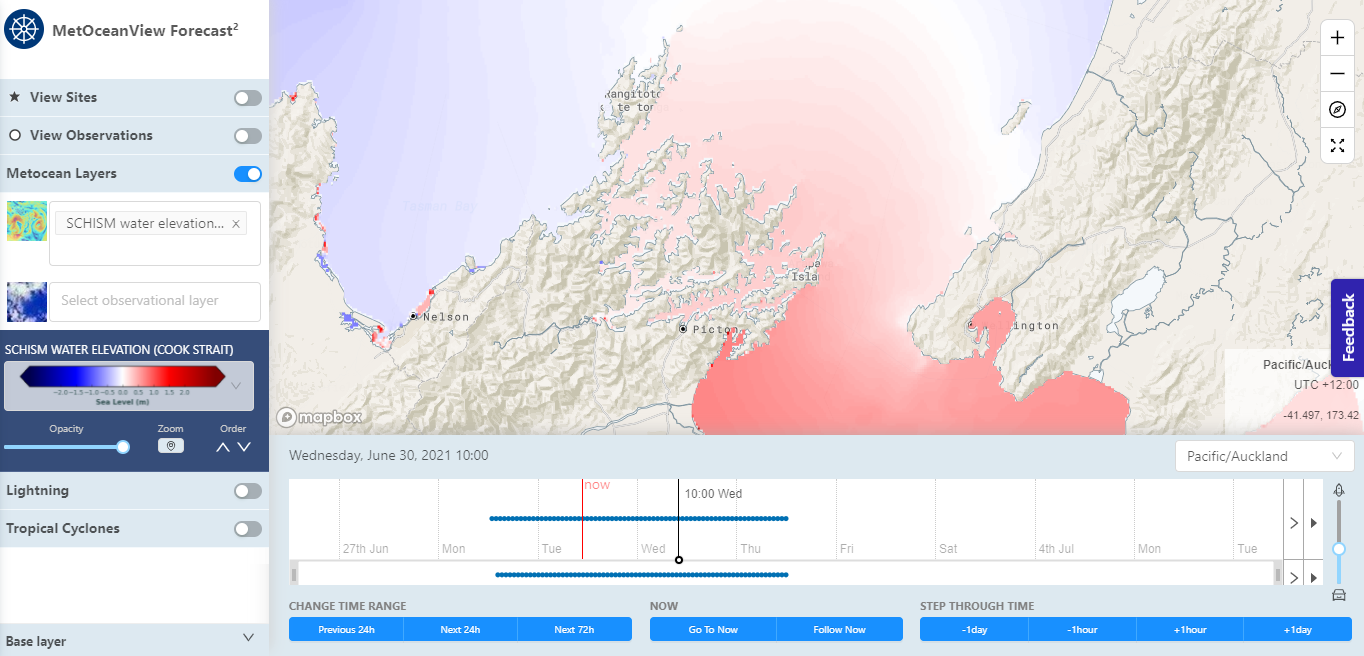
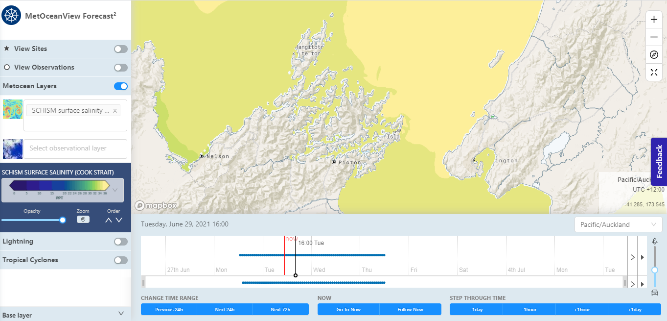
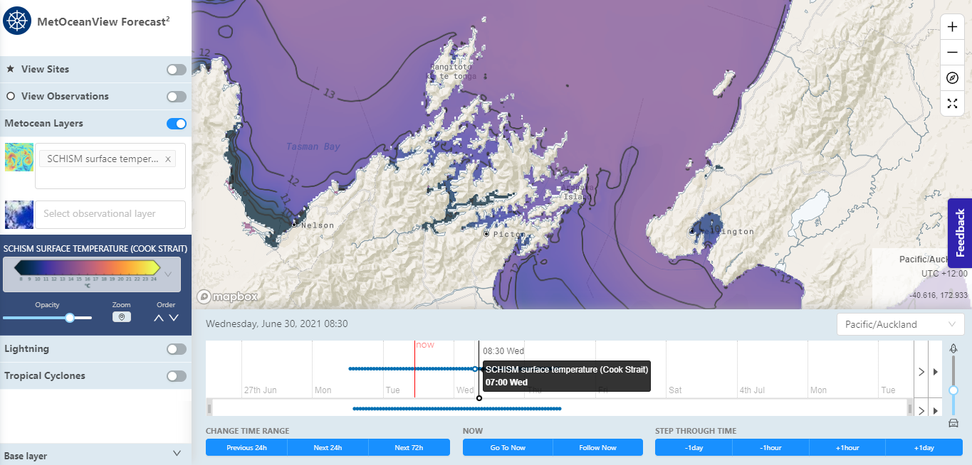
The forecast layers of surface water velocities, salinity, temperature and water elevation for both the Sounds and Cook Strait region are currently freely available in Forecast2 on MetOceanView.
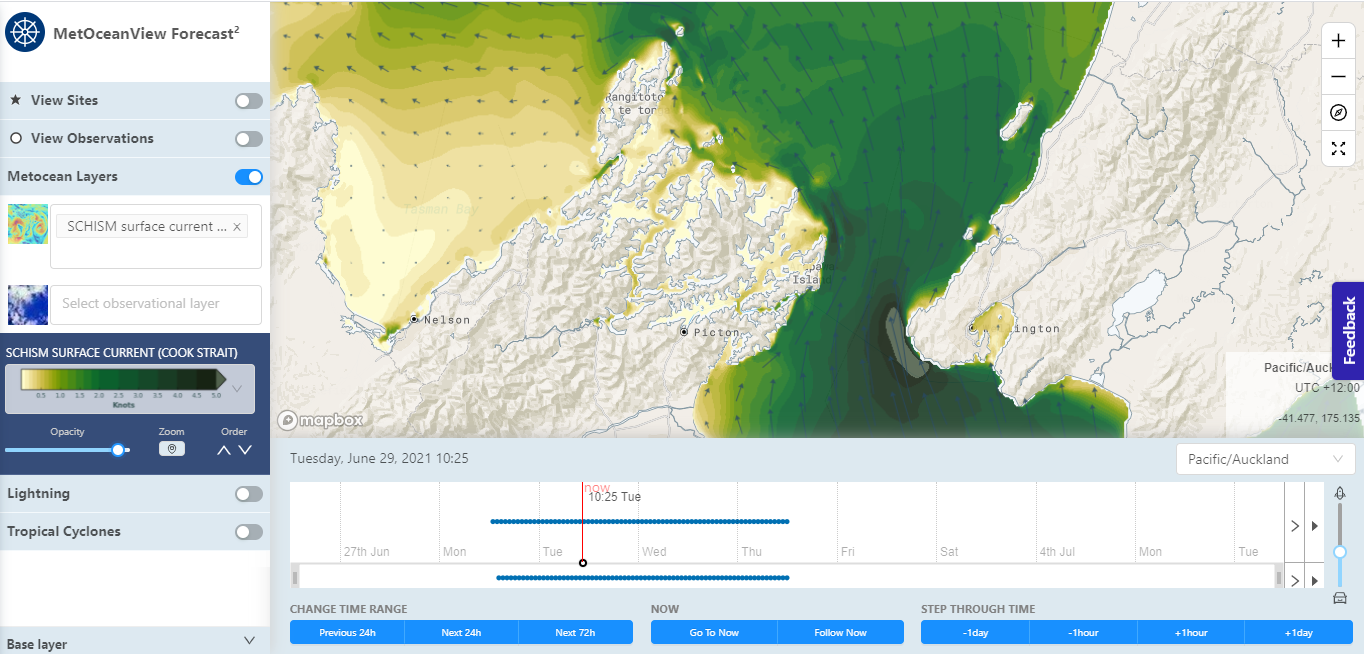
Example of forecast layers displayed at Forecast2 on MetOceanView platform.
Hydrodynamic Model Setup
The underlying forecast data is produced by a state-of-the-art unstructured hydrodynamic model (SCHISM), with offshore 3D boundary conditions sourced from the ROMS Moana backbone model (The Moana backbone model was sourced from the Moana Project, funded by the New Zealand Ministry of Business, Innovation and Employment, contract number METO1801). The SCHISM model is used extensively within MOS for both research and operational purposes, and is a key operational model for other national weather agencies around the world (e.g. The National Oceanic and Atmospheric Administration (NOAA) and the National Science and Technology Center for Disaster Reduction, Taiwan)
The model grid was developed with a resolution optimised to ensure salient hydrodynamic processes were accounted for; with horizontal resolution of approximately 2,500 m in the middle of the Cook Strait, reduced to 30 m near the coast and the entrance of the Marlborough Sounds. Within the sounds themselves, the resolution varies from 30 m near the shoreline to 100 m in the deeper parts. The model has over 38 vertical terrain following layers, providing detailed representation of current velocities, temperature and salinity stratification in the Sounds.
"The SCHISM model provides a powerful capability in high resolution operational coastal hydrodynamics,” says MetOcean Solutions’ oceanographer Dr Gael Arnaud. “The model domain encompasses the Cook Strait, Te Whanganui-a-Tara (Wellington Harbour), the South Taranaki Bight, the Golden and Tasman Bays and the Marlborough Sounds (both Pelorus and Queen Charlotte).
“SCHISM’s triangular mesh gives us an accurate representation of topographical features and engineering structures that work to modulate the hydrodynamic regime, or current patterns, within the confines of the Marlborough Sounds and the greater Cook Strait region.”
In terms of capturing the important meso-scale current patterns within the Sounds and the wider Cook Strait environs, this modelling represents a step-change in resolution beyond anything that has been operationalised previously and has the potential to significantly aid in the understanding and prediction of key processes that impact aquaculture in the region, as well as assisting with safer shipping and improved management practices.
“We’ve also included fluvial discharges from rivers such as the Pelorus River, as these fluvial inputs represent important forcing parameters for the model,” explains Gael. “In practical terms, this enables us to resolve river plume dispersion and storm surge with an extra degree of accuracy and therefore provide better forecast solutions to the end user.”
Valuable Information Provided
The model is a full 3-dimensional implementation, providing not only surface and profile currents but also forecasts of salinity, temperature and water elevation.

Example of high-resolution forecast of surface currents velocity (m/s) in the Pelorus Sound.
Ten Year Historical Data
In addition to the forecast model, MetOcean Solutions have recently completed a 10-year hindcast (2008-2018) of the region’s hydrodynamics, which includes defining the time-varying water elevation, velocities, water temperature and salinity of the Cook Strait and Marlborough Sounds using the same model (SCHISM).
The hindcast model was run as part of a project commissioned by Cawthron and The Ministry for Primary Industries (MPI). The hydrodynamic study of the Cook Strait and Marlborough Sounds was undertaken to allow statistically robust connectivity studies between marine farms within the sounds and to inform the offline MetOceanTrack tool (version 1) developed for MPI, which is used to predict the likely spread of invasive marine species.
“Historical datasets provide robust baseline data for project scoping and planning for offshore and coastal design, environmental impact assessment and input to other models,” says Gael. “We will be using the 10-year climatology from the hindcast to create a marine heat wave forecast for the Sounds. Marine heatwaves can have devastating effects on marine ecosystems, posing a threat to aquaculture and fisheries.”
The climatic data, alongside the forecast capabilities will allow us to predict the onset of these marine heatwaves within this nationally significant aquaculture area, providing the industry with an operational tool that will allow them to more efficiently manage their assets. In addition, we are looking to work with other scientific organisations (i.e. Cawthron/MPI) to establish if we can together provide predictions of harmful toxic algae outbreaks in the Marlborough Sounds, which has previously caused mass mussel farm closures (see https://www.stuff.co.nz/business/112380129/lab-in-a-can-tests-toxic-algae-as-marlborough-sounds-set-for-another-bloom)
Other Linkages
The model has been deployed to also support and enhance products and capabilities that are being developed as part of the Moana Project.
“At a national level, we recognise the importance of this area for the aquaculture industry, but also as a main artery between the North and South Islands,” says Dr Brett Beamsley, General Manager/Oceanographer. “As such, this modelling capability has been developed to support, and add to, the capabilities being developed as part of the Moana Project. Specifically, the high-resolution forecast and hindcast datasets from this modelling solution have been integrated into the new online MetOceanTrack service (version 2) that is in testing now internally and soon to be available to stakeholders in the Moana Project. This service has the capability to seamlessly link between global, regional and local modelling solutions to track the dispersion and transport of particles within the marine environment. Essentially, the service can be used to track invasive species, predict the fate of oil spills, inform Search and Rescue operations, manage dredging operations or even provide information on river plume dynamics and associated sediment dispersion.”
This fully online service provides stakeholders with an easily understood interface to some of the complex hydrodynamic and Lagrangian particle models used, with models being able to be run on demand, when needed and using the latest forecast data as well as archived hindcast data. Ultimately, it is MetOcean Solutions’ vision to not only allow the particle models to be run on demand, but also have a catalogue of hydrodynamic models ready to be spun up on demand and as required at similar resolutions to what MetOcean has for the Marlborough Sounds.
“One of the lessons we had from the RENA incident was that having relevant, high-resolution data is key to predicting the fate of contaminants in these high-impact events.” says Brett. “Back then it took us several days to spin up the necessary models for the response to the RENA, where we provided official guidance to Maritime NZ on the fate of the spilled oil. At the time, deploying operational models at that speed was unheard of, however now we are looking to improve the response time by adding to the capabilities being developed within the Moana Project and provide stakeholders with the capability to run these complicated, compute intensive models on demand. This will potentially enable the relevant agencies (e.g. Maritime NZ, Councils, MPI, EPA etc.) to have the best possible solution on where oil might travel within the marine environment, or where to look in the event of a search and rescue operation, or where invasive species might be transported to. This could really cut down the time for rolling out solutions from several days to hours and minutes.”

Example of dispersion modelling using the new online MetOceanTrack service.
Future Developments
Besides the Marine Heat Wave forecast for the Marlborough Sounds, MetOcean Solutions is also looking to deploy a 1.5 km resolution atmospheric model over the Cook Strait area, including Wellington and Nelson, and a 500 m resolution atmospheric model over the Marlborough Sounds.
“This high-resolution atmospheric model will provide more accurate wind fields in the Sounds, as well as a better atmospheric temperature distribution,” says Gael. “This enhancement of model forcing will increase the reliability and the accuracy of the forecast, particularly for marine heat waves.”
This represents a resolution of more than three times that of any national operational modelling solution currently available.
For further information about MetOcean Solutions’ operational forecast, please contact us at enquiries@metocean.co.nz