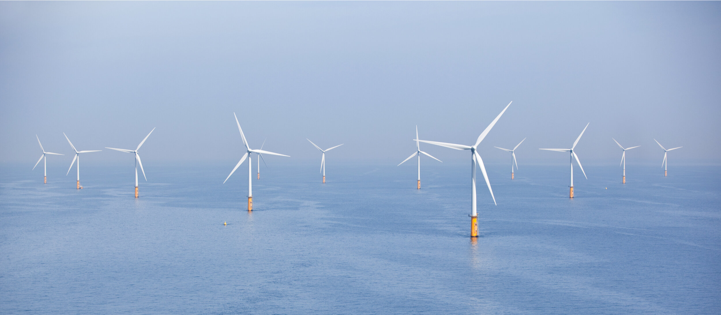
Offshore Renewables
Site specific surveys and solutions.
From coastal, shelf or deep water areas, we provide site specific weather forecast data, hindcasting services and customised solutions for all stages of an offshore project.
Our science team uses in-house models to model wind, wave and tidal data for any location on Earth. We have extensive experience supporting geophysical survey, exploration and construction operations.
Services for every stage of an offshore project

Exploration
Resource mapping of wave power, current flow, wind resource.

Site Analysis
Ultra high resolution modelling of proposed site.
Design
Metocean design reports: hindcasting, analysis and instrument deployment.

Installation

Operations

Demobilisation
Workability criteria for offloads and installation.
High resolution forecasting support.
Workability criteria and weather downtime analysis.
Offshore renewable energy assessment
Resource mapping
Mapping wave power, current flow or wind field for any site in the world to help operators find the best locations for offshore renewable energy. The resource mapping is based on our long term regional and high resolution hindcast data (up to 42 years).
Site reports
Site reports provide a detailed assessment of the oceanographic and meteorological conditions at the exact locations of interest. Based on up to 42 years of high quality hindcast information, a rigorous analysis of the waves, winds and 3D currents is supplied for guidance on design, installation and operational aspects.
Routing of heavy lift ships
Essential for installation and demobilisation of offshore wind farms and renewable energy devices.
Specialist marine weather forecasts
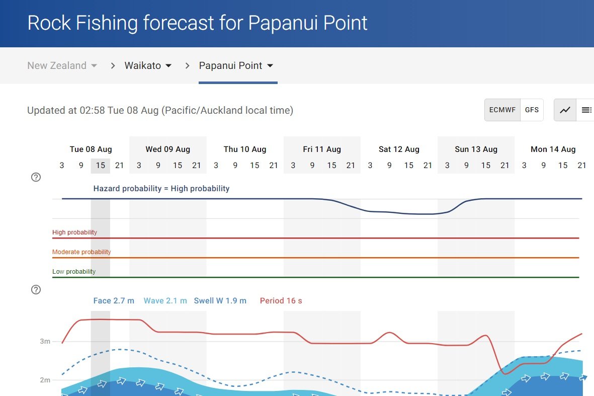
High accuracy forecasts provide customised guidance optimised for the project location. The services include high resolution automated forecast updates 4 times per day and derived guidance products such as workability, kinematics, vessel motion and real time guidance for installation, operations and maintenance.
Workability criteria and downtime analysis
Robust statistical information based on multi-year hindcast data to quantify favourable weather windows and downtime during critical installation and demobilisation stages.
High resolution forecasts anywhere on Earth
An extensive suite of in-house state-of-the-art numerical guidance allows accurate, high resolution forecasts to be provided at the exact location needed. The end user forecasts are highly detailed yet presented in an easy to understand format, available 24/7 by web access or auto email updated every 6 hours.
Historical weather services
Our hindcast data provides high quality marine weather data from multi-year numerical model simulations for any location on Earth. Historical data archives reach back to 1979 offering key baseline data for project scoping, offshore and coastal design, project planning and environmental impact assessments.
Scientific consultancy services
Use our experienced scientific team to gain a thorough understanding of the meteorological and oceanographic processes relevant to your project. We have extensive experience working across a wide range of environments, and routinely apply the latest tools and analysis techniques for coastal, port and offshore developments.
Latest news