Over Two Decades of Oceanographic Services in the Taranaki offshore fields and the Port
Taranaki – Metocean Solutions is marking more than 20 years of supporting the maritime industries in Taranaki – from helping port and offshore operations, green-field investigations and development and through the entire decommissioning lifecycle. Metocean Solutions is proud to have worked alongside companies and organisations that are not only key contributors to the Taranaki economy but have helped shape the maritime industry of the region by applying sound industry focused scientific analysis and investigations.
As Taranaki continues to evolve as New Zealand’s centre for energy and marine development, the company’s work remains closely tied to the region’s coastal environment and offshore infrastructure.
Supporting Taranaki’s Coast
Over the past two decades, Metocean Solutions has contributed to many of Taranaki’s key maritime projects, helping engineers and planners better understand the powerful wave climate of the Tasman Sea.
One of the company’s most notable investigations followed the severe storm of September 2005, which caused sections of the Port Taranaki Main Breakwater to collapse. Using advanced numerical modelling, Metocean Solutions analysed the wave overtopping forces involved, helping engineers design more resilient coastal structures.
The company also supported the Port Taranaki 2040 Master Plan by modelling multiple harbour configurations to determine how breakwater extensions could reduce wave agitation at port berths and improve operational conditions. This work formed part of the early-stage investigations into the potential development of an LNG terminal at Port Taranaki.
Understanding the Marine Environment
The team has developed high resolution validated metocean models spanning up to 47 years, providing a detailed picture of the marine climate around New Zealand. These datasets have supported studies for numerous offshore energy assets, including offshore operations (Maui), as well as greenfield developments such as Pohokura, Kupe and Maari, helping engineers assess conditions for pipeline stability and offshore infrastructure design.
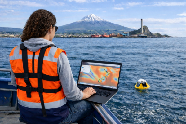
Field instrumentation also plays an important role in validating these models and providing real-time observations. We regularly deploy oceanographic instruments such as wave buoys and pressure sensors to measure windseas, swell and longer period waves. These measurements help improve model accuracy and provide reliable data for offshore operations and coastal management.
We have analysed extreme events such as the 2017 storm that tore a CALM buoy from its moorings and carried it onto Ngāmotu Beach, New Plymouth, demonstrating how numerical modelling can help reconstruct severe marine conditions.
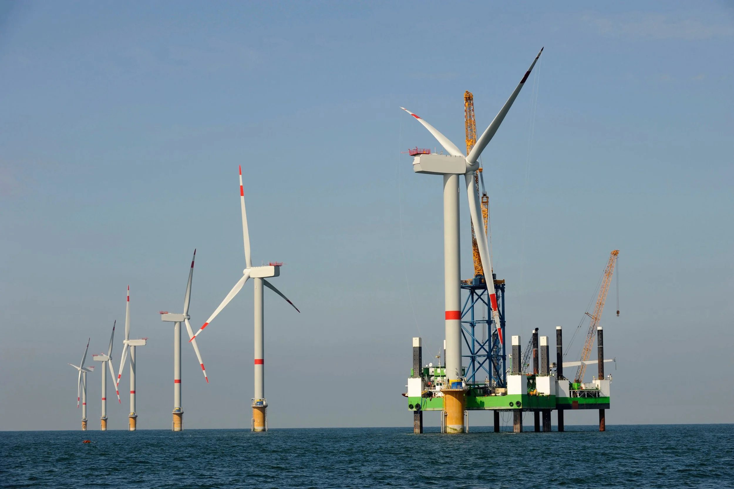
Looking Ahead: Energy and Offshore Wind
Taranaki remains central to New Zealand’s energy sector, and future developments (such as the LNG terminal) are likely to rely heavily on understanding local ocean conditions. Potential projects such as offshore wind farms and other marine infrastructure also require detailed knowledge of winds, waves and currents to guide engineering design and safe operations.
Long-term environmental datasets and high-resolution modelling are increasingly important for assessing vessel operability, infrastructure resilience and the impacts of extreme storms.
As Taranaki explores new opportunities in renewable energy and marine industries, the region’s strong foundation in ocean science will remain essential.
After more than two decades in New Plymouth, we remain committed to advancing the understanding of New Zealand’s marine environment and supporting coastal and offshore development through sound scientific knowledge