
PIANC Australian Coast and Ports 2025 Conference Summary
The Consultancy Team from the Research and Innovation Hub recently attended the PIANC Australian Coast and Ports Conference 2025 at the end of August. This year’s edition leaned a little more toward the engineering side, but it was still a great showcase of the real-world applications of the work we do. Within the Consultancy Team, we collaborate on demand with groups around the world, supporting assessments of coastal structures, planning, and development — all of which rely on understanding how the ocean works to ensure durable and efficient solutions. Since most of these interactions happen online, the conference was a fantastic opportunity to meet in person the people we usually only talk to through a computer screen, to strengthen our connections and to build new relationships.

Figure 1: The Consultancy team during their oral presentations. From left to right: Mariana Cussioli (RIH), Holly Watson (RIH), and Mireya Montano (RIH).
The team presented a variety of topics to showcase the consultancy’s range of expertise. Mariana Cussioli presented her paper on “Testing wave transmission: Reproducing mussel farm dynamics in a numerical model”.
Coastal structures can have an impact on the sediment transport and wave dispersion on the coastal regions, modifying the beach width and even the quality of surfing waves. Factors such as orientation, position, and size all play an important role — and even natural-like features such as mussel farms can have measurable effects that need to be assessed. Her talk outlined a methodology for simulating mussel farm lines in a wave model and explored their potential impact on wave attenuation as waves pass through and interact with the farm’s structures.

Figure 2: Example of mussel farm lines wave simulation, highlighting the difference in wave height between a design that includes mussel farm lines and one without.
Holly Watson presented her paper “Comparison of Coupled SCHISM/WWM-III and DelftFM/SWAN for Wave–Current Dynamics in Tidal Inlets”
She compared the strengths and limitations of the two coupled wave-hydrodynamic softwares which we use in our consultancy projects, drawing on the extensive suite of models developed at MetOcean Solutions such as the SCHISM/WWM-III coupled models of Tauranga and New Zealand (storm tide), and the DelftFM/SWAN coupled models of Manukau and typhoon simulations in Taiwan.
For most of our studies, getting the resolution right is key to accurately capturing all the relevant coastal processes. We often rely on unstructured models, such as SCHISM and DelftFM, which use irregular meshes of triangles and quadrangles to provide high resolution where needed while keeping coarser resolution offshore to balance accuracy and computational cost.
Holly shared how each model performed across a range of dynamic environments and conditions and most importantly their ability to accurately represent physical processes and their computing efficiency — insights that are highly relevant to a project’s delivery and timeframe.

Figure 3: SCHISM/WWM-III computational mesh for Tauranga Harbour, showing finer resolution inside the harbour, in shallow areas, and other key locations compared with the coarser mesh in deeper, offshore waters.
Finally, Mireya Montaño presented her paper on “Drifting and Tracking – Where Do Floating Things Go?”.
She explained how Drifting and Tracking can be a valuable planning and impact assessment tool — for example, when designing wastewater outfalls, lagrangian particle tracking modelling allows to test different discharge rates (which are currently increasing due to population growth) and assess the areas and timeframes that could be affected under various environmental conditions.
It is also essential for “reaction” situations, such as oil spills or search-and-rescue operations. Mireya highlighted the current tools and capabilities within the Research Hub and Innovation group, including the “MetOcean Track” feature in the Insights Platform, as well as in-house developments like using SurfZoneView results for quick, cost-effective simulations — provided bathymetry and real-time conditions are available.
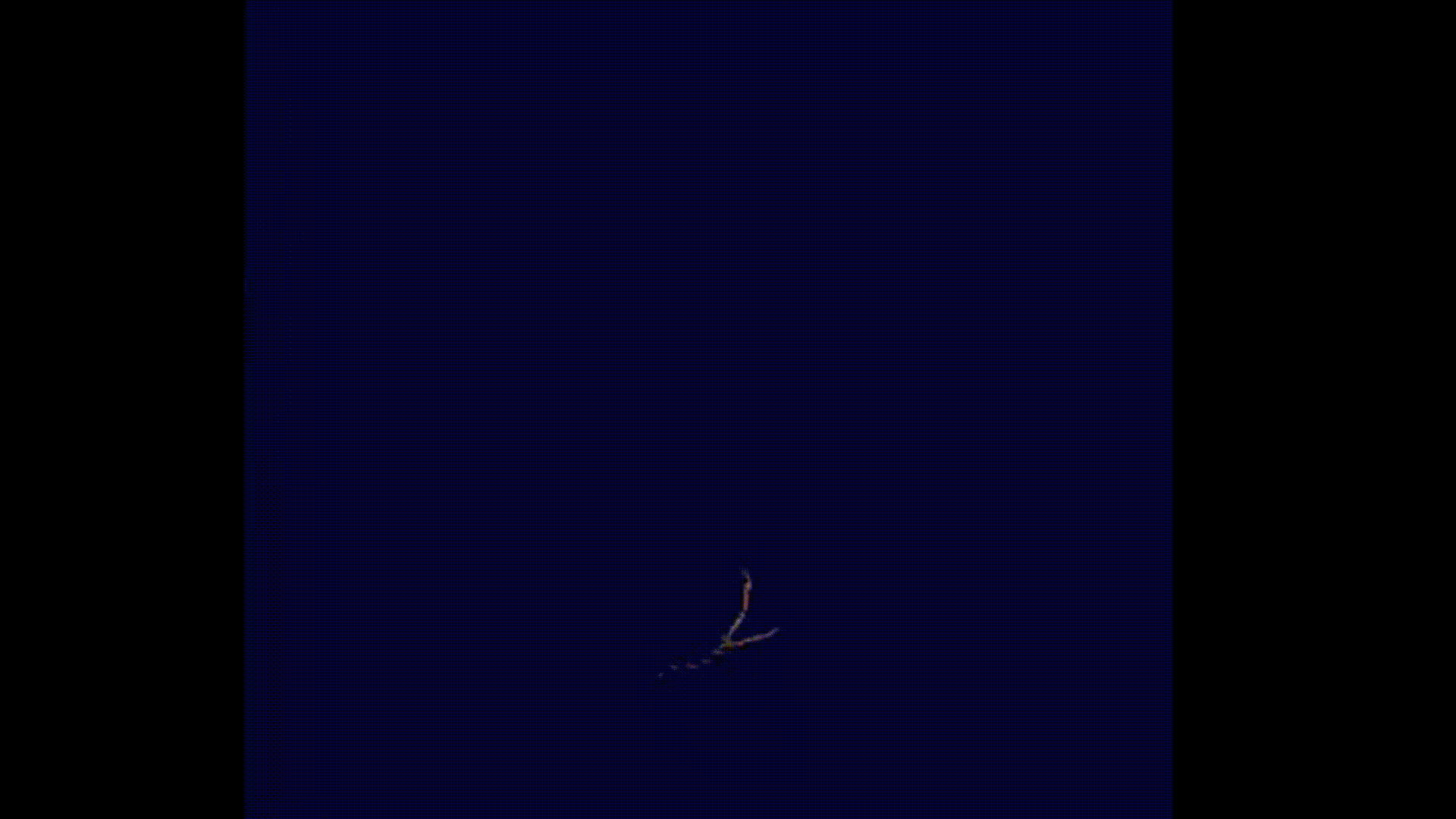
Figure 4: Coastal particle tracking animation. Ocean Dynamics can look stunning, right?