
Modelling tsunami propagation to New Zealand coast
On Friday March 5th, three severe earthquakes struck along the Kermadec Trench, with each subsequent earthquake stronger than the last. The earthquakes resulted in authorities issuing tsunami alerts throughout the South West Pacifici Islands, including New Zealand.
The first 7.2M earthquake struck at 2:27am (13:27:36 UTC) off the East Cape of the North Island, 105 km east from Te Araroa. The second, at 7.7M, occurred at 6:41pm (17:41:24 UTC) in the Tonga-Kermadec subduction zone, near the Kermadec Islands and the third at 8.1M was also near the Kermadec Islands, at 8:28 pm (19:28:32 UTC), and represented an earthquake that was almost 8-times larger and 22 times stronger than the initial 7.2M earthquake.

These earthquakes were the result of a reverse fault mechanism, where a hanging wall is displaced upwards. Such reverse fault earthquakes are responsible for most tsunamis, and particularly the larger events.
“These events were recorded by multiple instruments, including tide gauges and Dart Buoys 1 , providing crucial information on their magnitude and the way they propagated,” says Dr Gael Arnaud, oceanographer at MetOcean Solutions. “This information is used to calibrate our models and hence to improve the propagation prediction.”
Being able to compare these Tsunami models with actual events is vital, as it allows us to have confidence in the modelling approach and pre-run outcomes. To simulate the tsunami, we use the moment tensor provided by USGS to model the source and the bed deformation based on the Okada (1985)2 model. The initial wave is then computed, and the model will use this wave state as a hot start to propagate the tsunami, as shown in the animation in Figure 1. The simulation shows the tsunami triggered during the 8.1M event near the Kermadec islands (Figure 1) for which the maximum elevation is presented in Figure 2. The waves are propagating around the source and reach the Northern coast of New Zealand between one and two hours after the earthquake, with a wave height range of about 10 to 50 cm.
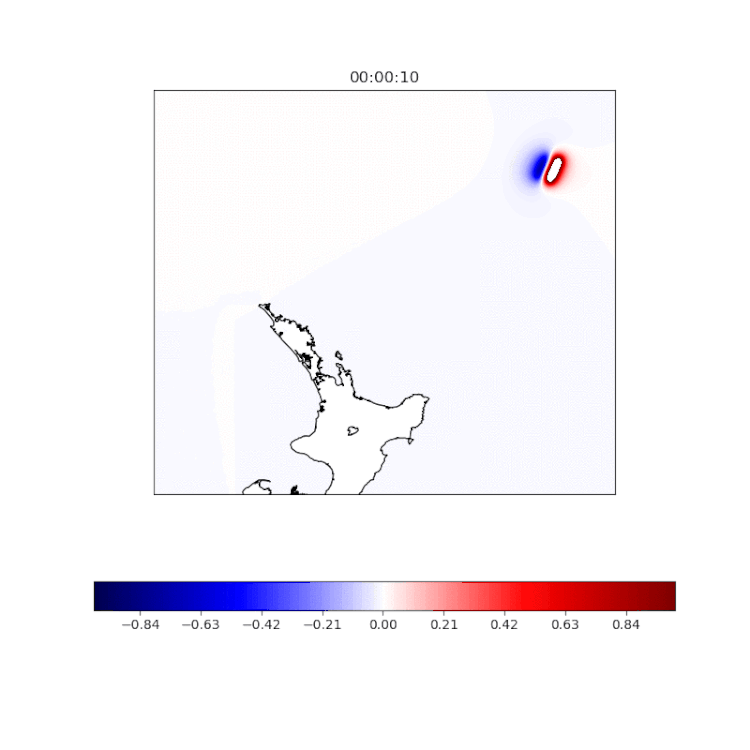
Figure 1 – Animation of the tsunami elevation (m) triggered during the 8.1M event near the Kermadec islands.

Figure 2 – Maximum elevation (m) modelled of the tsunami triggered during the 8.1M event.
Tsunami wave heights are then compared with water level measured by tide gauges, shown on Figure 3 for the East and North Capes, Chatham Island and Great Barrier Island.

Figure 3 – The graphs show the water level measured (blue line) at the East and North Capes, Chatham Island and Great Barrier Island tide gauges during last week tsunami event. The red line on each signal indicates the preliminary result of MetOcean’s tsunami model simulation. Note that tidal waves have been removed.
“The model simulated 6 hours of propagation and the amplitudes are quite consistent with recorded amplitudes at tides gauges, although amplitude remains over-estimated at Great Barrier Island,” says Gael.
“Arrival times are also consistent, with the modelled waves predicted to arrive only a few minutes before the measured ones. Wave attenuation after the event also seems important in the model as agitation remains significant even 12 hours after the first wave, as seen in the Chatham Island data.”
“The results of our preliminary tsunami model simulation are promising, with further adjustment required to have a more accurate reproduction of the propagation.”
What is a Tsunami? Tsunami waves are identified as the water level oscillates in larger range than normal infragravity and far infragravity 3 waves. A Tsunami is a series of extremely long waves (multiple waves tens-to-hundreds of miles between crests) caused by a large and sudden displacement of the ocean 4 .
For more information about New Zealand’s tsunami monitoring and detection network, access www.civildefence.govt.nz/get-ready/get-tsunami-ready/
Contact us at enquiries@metocean.co.nz for more information about our modelling capabilities.
---
- DART (Deep-ocean Assessment and Reporting of Tsunami) buoys are deep-ocean instruments that monitor changes in sea level. www.civildefence.govt.nz/get-ready/get-tsunami-ready/tsunami-monitoring-and-detection-network/
- Okada, M. 1985. Surface deformation due to shear and tensile faults in a half space. Bulletin of the Seismological Society of America, 75(4): 1135–1154.
- Infragravity waves are typically generated in the surf zone by the wave breaking process. They have periods of between 30 and 120-150 seconds and in many locations, they are modulated by the tide level. Far Infragravity waves are generated by wave groups and can be released into a harbour as the group passes the entrance or reflected from the coastline. They have periods of between 2 and 60 minutes and are not usually modulated by the tide level.
- https://ntwc.ncep.noaa.gov/